SUCCESS STORIES
See for yourself how our customers have used our big data analytics on 3D point clouds to propel their projects to success. Read about how our universal 3D point cloud platform can overcome challenges and generate insights for the management of physical assets, sites and environment.
Point Cloud Analytics for Updating 3D City Models

Industry:
- Public sector,
- City planning,
- Surveying company.
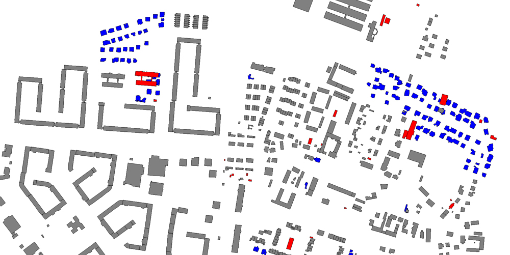
Challenge: Together with Berlin Partner and the Senate Office of Berlin we addressed the challenge to update the 3D city model of Berlin in an efficient and automatic way. The main challenge was the massive amount of 120 TB raw data for an area of 900 km² covering 530.000 buildings. The task was to identify only those buildings that are new, outdated, or have been changed and required an update in the 3D model.
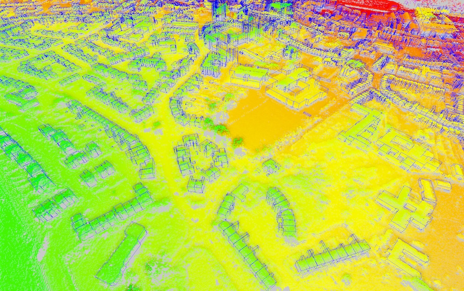
Solution: Point Cloud Technology provided its platform to classify 3D point clouds from new aerial scans into ground, building, and vegetation. Change detection approaches where used to compare the new data with previous scans and the 3D city model. A GPU-based processing was used to implement a fast processing workflow. Through the use of the platform the detection of buildings and sites that need to be updated was possible in a fully automatic way.
Result: Point Cloud Technology was able to support Berlin’s mission to provide an up-to-date 3D city model for the entire city. Manual effort has been kept to a minimum to avoid high costs and provide the results immediately.
Point Cloud Analytics for Infrastructure

Industry:
- Public sector,
- Urban planning,
- Mapping agencies.
Challenge: Together with Oracle we solved the challenge to implement multiple point cloud processing and analytics workflows using database technology for a national mapping agency. The main challenge was the dense and nationwide data that has to be managed with Oracle Spatial and Graph.
Solution: Point Cloud Technology provided its platform to import, analyze and visualize 3D point clouds. The platform was connected with an Oracle Spatial and Graph Databases as a storage for point clouds. In addition, we used an Oracle Exadata Database machine, which is an integrated system that combines high-performance computing and storage hardware with database software, to perform analysis tasks and improve the processing performance.
Result: Point Cloud Technology was able to support Oracle‘s mission to provide an all-in-one solution for 3D point clouds that includes hardware, database storage and processing applications. Furthermore, by using Point Cloud Technology’s services the customer is able to uphold its reputation that the way in which they capture and provide data is internationally renowned. “The Point Cloud Technology platform helps us to revolutionize the way we can provide automatic workflows. We cherish the insights we gained by using the platform.”
Point Cloud Analytics and Documentation for Infrastructure

Industry:
- Public sector,
- Urban planning,
- Construction business,
- Transport infrastructure network providers.
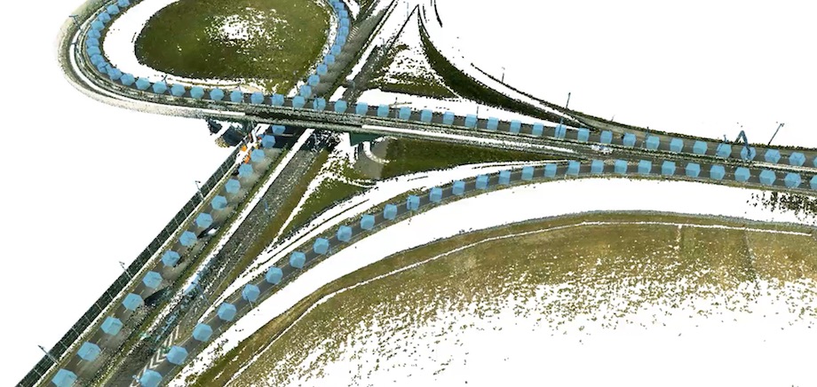
Challenge: Together with SHH in Poland the challenge was to provide a solution for aerial point clouds of entire Poland and mobile mapping point clouds of cities. One focus was the management of the Polish road and rail system including automatically detecting assets and requirements for maintenance works.
Solution: Point Cloud Technology supplied its platform to analyze dense mobile mapping scans of infrastructure networks. In addition, it was used to derive digital tree cadasters from aerial 3D point clouds using Point Cloud Technology’s vegetation analytics tools. Through the use of the platform different departments can constantly monitor and document the environment. Moreover, our web-viewer is used to provide data and processing results.
Result:For the management the adoption of the Point Cloud platform signified a great success as they can improve their maintenance planning to run faster and more effectively.
A user states: “The Point Cloud platform has tremendously improved our planning. We are able to control road availability, safety and increase the lifetime of our roads in such a way that was never possible before.”
Point Cloud Analytics from UAVs

Industry:
- Public sector,
- Construction business,
- Real estate,
- Insurance companies.
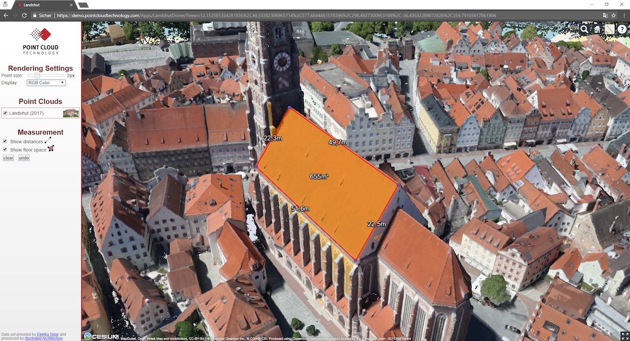
Challenge: Together with DR1 DRONE-SERVICES and illustrated architecture we addressed the challenge to capture the reality on demand to provide insights for facilities, sites and built infrastructure. One focus was the data acquisition with a UAV to document the state-of-the-art. The challenge was to provide a platform for interactive inspection.
Solution: Point Cloud Technology supplied its platform to create a digital 3D representation of the reality captured with UAVs. The platform provided tools to explore, inspect, and measure the data to draw conclusions. In addition, classification and processing approaches were used to automatically estimate the value of assets.
Result: For the customers the implementation of the platform signified a great success as they can improve their decision planning based on real-world data.