Vegetation
Automatic detection, classification, assessment and monitoring of vegetation and biomass for forest management, infrastructure network management and municipalities. Our proven solution opens new opportunities for urban planning, landscape architecture and other fields by automating maintenance and management. Vegetation analytics reduces manual effort while increasing speed, transparency, and accuracy. Any data is possible, such as area-wide aerial survey data from all seasons, as well as mobile mapping and UAV data.
Sectors:
cities, municipalities, infrastructure/network operators, agriculture, and forestry
Use cases
DOCUMENTATION
Easy monitoring and detection of vegetation with the possibility of matching the documentation with existing vegetation cadasters and then updating it. Discover and explore urban areas and entire cities regarding vegetation. Automatic derivation of tree cadasters, with information on position, size, color and risk to infrastructures. Growth monitoring enables predictive maintenance of trees along diverse assets and infrastructure.
CLASSIFICATION
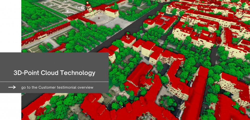
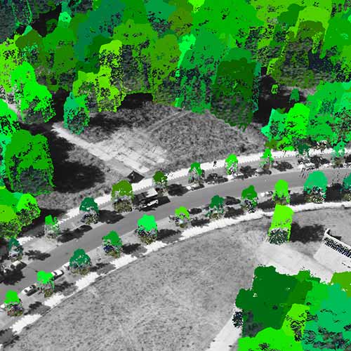
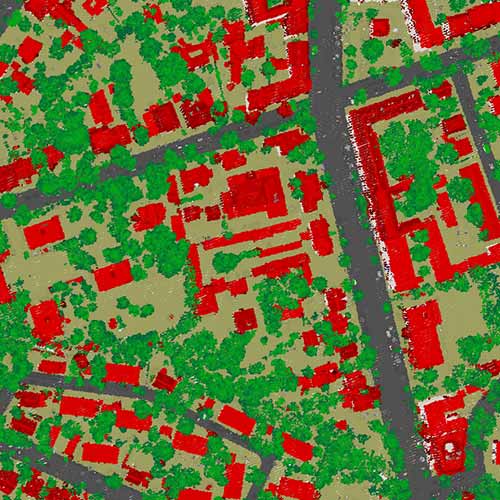
The value of point clouds is significantly increased by semantic information. Automated and precise categorization of data provides new insights into the condition and structure of vegetation and forests in cities and wide-area landscapes. Automated classification of physical assets enables efficient and rapid analysis of vast amounts of data. Vegetation can be classified and put into value based on different criteria.

CHANGE DETECTION
Regular data collection enables targeted monitoring and detection of changes. Use cases related to vegetation include efficient updating of cadastral data, damage assessment after natural disasters, evaluation of processes around forestation and deforestation, growth rate of vegetation, etc.
DEMO
SUCCESS STORIES
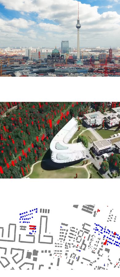
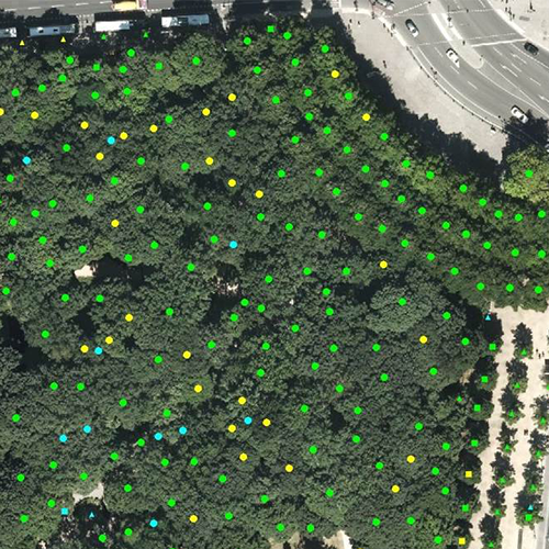
Tree survey and comparison with current cadaster of Berlin
Challenge
Comprehensive aerial data of the entire urban area is available for the city of Berlin. The requirement was to detect all important objects within the aerial data, including the vegetation and particularly the tree population.
Solution
With the help of our point cloud technology, the large amounts of data resulting from the aerial survey were automatically analyzed using machine learning. Single trees were detected which also meant that all trees were automatically counted. The detected trees were matched with the tree population in the official tree cadaster of the city.
Result
The comparison with the official tree cadaster showed that the actual number of trees significantly exceeds the number in the cadaster. The official cadaster contains approximately 430,000 trees, while Point Cloud Technology’s automated tree detection system identified over 10 million trees in Berlin.
Download Success Story
More projects